
BilbaoAccess
OBJECTIVES
Development and implementation of an automatic vehicle access control system for areas with special traffic conditions in order to regulate and control pedestrian preference zones and thus facilitate coexistence in these areas with the mobility needs of different groups (residents, shopkeepers, hoteliers, etc.).
The first area to be integrated into the new control system was the Old Quarter, and other pedestrian areas of the city will gradually be incorporated.
DESCRIPTION OF ACTIONS CARRIED OUT
• Definition of entry conditions and authorised profiles.
• Identification of the specific needs of Bilbao City Council and the different economic activities affected.
• Development of a Control Centre for the correct management, operation and compliance with access conditions.
• Definition of integrations with municipal and extra-municipal information systems.
• Development of a municipal mobile application so that users can manage their authorisations.
• Installation of 30 Control Points in the Old Town area.
• Development of tests in the 3 municipal environments and coordination with the Municipal Police in order to define the applicable sanctioning process.
KEY SUCCESS FACTORS
• Provision of a Citizen Service Office to provide information, both in person and by telephone, on the conditions of access to the Old Town site.
• Use of different communication strategies (information through municipal channels, information leaflets, etc.) to inform citizens about the implementation of the access control system.
• Clear definition of objectives and scope from the beginning of the project.
• Involvement of the different municipal agents: BilbaoTIK, Public Safety and Economy and Finance.
MAIN RESULTS ACHIEVED
• Promotion of sustainable mobility.
• Reducing the level of vehicles circulating in the Old Town, reducing greenhouse gases and the noise generated by them.
• The reduction in traffic has contributed to an increased sense of security among the elderly and increased local economic activity.
• The automation of registration processes has made it possible to speed up procedures for citizens with mobility needs.
• The automation of control processes has reduced fraud generated by unauthorised access to priority areas.

Bogotá Smart Territory
The Bogotá Smart Territory Policy establishes an implementation horizon from 2023 to 2032, promoting sustainable solutions based on data.
OBJECTIVES
Consolidate Bogotá as a Smart Territory by promoting the use and exploitation of data, technology and innovation by the actors and sectors of the territory, to solve problems and generate opportunities that improve people's quality of life.
DESCRIPTION OF ACTIONS CARRIED OUT
The Bogotá Territorio Inteligente 2023-2032 Public Policy is an initiative led by the High Councillor for ICTs of the General Secretariat of the Office of the Mayor of Bogotá. Its formulation process began in 2021 and went through different phases: preparatory, public agenda and policy formulation. As a result of this process, the final version of the action plan of the Bogotá Smart Territory Public Policy was generated. This action plan includes 7 specific objectives, 7 results and 36 products that will be the responsibility of 14 district entities of the Mayor's Office of Bogotá. The policy was approved on 31 May 2023 and is valid for 10 years.
KEY SUCCESS FACTORS
The Bogotá Smart Territory Policy establishes an implementation horizon from 2023 to 2032, promoting sustainable solutions based on data, technology, and innovation, and seeks an intersectoral intervention for the development of a smart territory in Bogotá.
MAIN RESULTS ACHIEVED
During the process of formulating the Bogotá Smart Territory Policy, the insufficient conditions were identified to develop a collective intelligence based on data, technology and innovation that efficiently responds to the city's problems. Sixty joint construction spaces were held with the participation of more than 24,000 people from different sectors, where the problematic situation was characterised, and strategic factors were defined using design thinking methodologies. Subsequently, the action plan was drawn up in 22 virtual roundtables with public servants and feedback was received from the entities, resulting in the approval of the Bogotá Smart Territory Public Policy on 31 May 2023, with 7 objectives, 7 results and 36 products in charge of 14 district entities for a 10-year period.

Bilbao WIFI
OBJECTIVES
To offer a free, free and universal WIFI network. Promote collaboration and link communication networks and state-of-the-art WIFI infrastructure between agents in Bilbao (universities, sports and cultural centres, leisure and health facilities, means of transport, etc.) and the municipal network "Bilbao WIFI" in order to offer new and better services to citizens. To expand the WIFI points in the city.
DESCRIPTION OF ACTIONS CARRIED OUT
Bilbao continues to expand the municipal WIFI network, open and free, throughout the city, which favors the possibilities of increasing productivity and generating business. At present, practically 100% of the residents of the city have municipal WIFI coverage within 300 meters of their homes. With approximately one hundred thousand people a day using it (one out of every three citizens), it allows us to have a very representative sample of the city.
In addition to a service for citizens, the deployment of quality connectivity provides valuable information for city planning and governance. On the other hand, the deployment of fixed broadband throughout its territory places Bilbao in an excellent position to take on the challenge of deploying the 5G network and services.
The wifi zone closest to the citizen can be consulted at: www.geobilbao.eus
KEY SUCCESS FACTORS
Over the next two years, network coverage will be significantly increased, guaranteeing that practically one hundred percent of the population will have a WiFi point within one hundred and fifty meters of their homes.
MAIN RESULTS ACHIEVED
In the field of mobility, for example, the communication system with the BilboBus units has been completely improved, highlighting the interconnection of the WIFI network of the units with the municipal networks.
The location and other intrinsic and inferred values of each terminal are known, with maximum respect for privacy. And among the inferred ones, we could mention some such as:
- Number of people who like soccer or basketball depending on whether they go to San Mamés (soccer field) or Bilbao Arena (Basketball).
- Number of people who like theatre or opera as a function of the number of visits to the Arriaga Theatre or the Euskalduna Conference Center where opera is performed.
- The same happens with the number of people who visit the Guggenheim Museum Bilbao or the Museum of Fine Arts.
- Through heat maps, we can accurately infer in real time the number of people in each area of the city.
On the other hand, for example, Metro Bilbao continues to expand its free wifi points and now reaches 35 stations (July 2023).
And with the most absolute ethical and moral guarantees and the greatest respect for privacy, there are many applications or information obtained, for example:
- Determining the appropriate width of a sidewalk in an urban reform.
- Crowd control and measurement of crowds.
- Support for the improvement of public transport intermodality.
- Measurement of the "commercial success" of different spaces and infrastructures in the city (libraries, squares, gardens, playgrounds, ...).

Growing Together
The city has launched the Growing Together project, which will update the planning framework for these transit station areas, enabling and encouraging responsible growth for the future.
OBJECTIVES
A significant percentage of growth in Kitchener is occurring around areas of the ION LRT light rail system. Building and growing around public transit is a fundamental tenet of Ontario's planning framework. Growing Together will update the planning framework for these areas, known as Major Transit Station Areas, allowing, and encouraging responsible growth for the future.
DESCRIPTION OF ACTIONS CARRIED OUT
Growing Together is a pioneering project in its integration of the physical and digital worlds, leveraging the same 3D model and methodology to communicate complex content to the public and build shared understanding. It also generates a multitude of growth scenarios and quantitative metrics directly related to community participation.
KEY SUCCESS FACTORS
Focus on community involvement. The City of Kitchener has been working closely with local organizations and residents to identify the most pressing needs and opportunities in each neighbourhood. This has involved a variety of activities, including community consultations, surveys, and workshops, including soliciting feedback through the use of a 3D printed city model.
MAIN RESULTS ACHIEVED
Engaging nearly 600 residents with the 3D printed model since January 2023, translating workshop results into multiple growth scenarios within the smart model and generating quantitative data for comparison, and engaging the community in creating growth scenarios for comparison and evaluation using data, meaning residents will be directly connected to policy and strategy outcomes. Finally, the project has won two awards to date: Smart50 award and a Municipal Systems Excellence 2023 award.
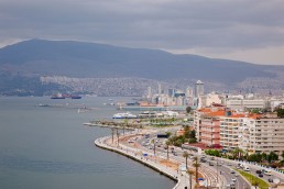
Cittaslow Metropolis - ‘Cittaslow Neighborhood Program’
Streets designed with the participation of city residents increase the sense of belonging to the city, communication, and appropriation of practices.
OBJECTIVES
Decelerate and protect the city's urban environment and nature. Targets were set in six areas: community, good governance, mobility, urban resilience, access to good food and slow neighbourhoods.
DESCRIPTION OF ACTIONS CARRIED OUT
Analysis involving representatives of society, professional chambers, experts and academics were conducted with the aim of understanding life in İzmir and the metropolitan city in general. These analyses also considered the prevailing global views in this area and were compared with Cittaslow's philosophy. From this perspective, priority issues to be addressed in the Cittaslow model were identified.
KEY SUCCESS FACTORS
Social solutions have strengthened urban identity and the sense of belonging in the neighbourhoods. The success of spatial solutions has been based on the use of tools such as Slow Spaces, by closing areas to vehicular traffic and establishing places for pedestrian use.
MAIN RESULTS ACHIEVED
Streets can become more liveable areas not only through the design of the physical environment, but by becoming owned by users of all ages. The inclusion of city residents in the design process ensures transparency and equity in the decisions made. By designing streets with the participation of residents, the sense of belonging to the city is strengthened, communication is fostered, and ownership of urban practices is promoted. As part of the Cittaslow Neighborhood program, a citizen participation process was carried out to identify the problems, needs and potential of the neighbourhood based on residents' opinions and responses.